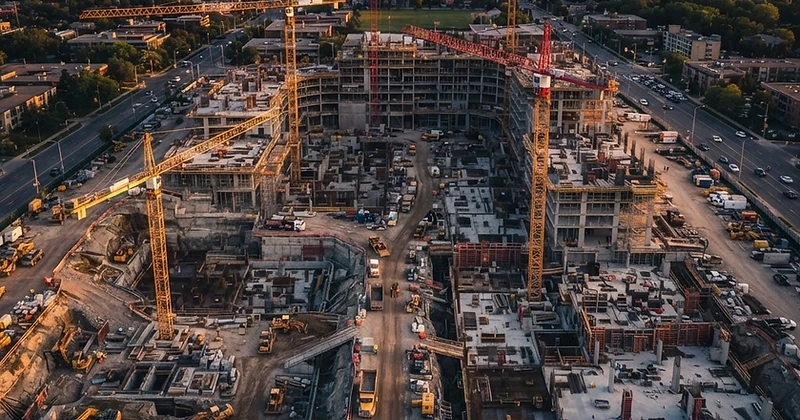
Construction Support
Pre-Construction Site Documentation
Aerial Mapping and Existing-Condition Records
Aerial capture can give developers, contractors, designers, and property teams a current overview of a proposed site. Skyline collects visual data that can be processed into orthomosaics, digital surface or elevation views, photogrammetric 3D models, and approximate measurements when the site and project requirements support those deliverables.
Skyline is not acting as a licensed land surveyor, civil engineer, geotechnical professional, wetland specialist, or code official. Unless a project is specifically designed and controlled by the appropriate licensed professional, aerial products are planning and documentation tools rather than legal surveys, design surfaces, boundary determinations, or engineering conclusions.
Applications
What We Deliver
Existing-Condition Mapping
A planned aerial capture can document visible roads, structures, vegetation, drainage features, staging areas, and surrounding context. The resulting imagery gives project teams a shared reference for early discussions and site walks.
Elevation-Surface Visualization
A photogrammetric digital surface model can help teams visualize visible slopes, structures, vegetation, and relative elevation changes. Accuracy depends on equipment, flight design, surface texture, positioning, control, processing, and validation. Standard deliverables are reference and documentation products, not surveys, design surfaces, or certified elevations.
3D Site Context
A photogrammetric model can provide an interactive, measurement-capable view of existing visible conditions. Select viable projects may also support a high-fidelity Reality Model for immersive visual review. Reality Models are visual scene products and are not measurement, survey, boundary, structural, or environmental deliverables.
Remote Site Review
When connectivity permits, off-site stakeholders can join a scheduled live aerial review and request views of accessible areas. The pilot retains control of the flight and all safety and regulatory decisions.
Benefits
Benefits for Your Team
Shared Site Context
Give owners, contractors, and consultants a current visual reference before detailed design or mobilization.
Accessible Overview
Document large, uneven, or difficult areas without requiring every stakeholder to walk the full site.
Scope-Appropriate Products
Match the deliverable to the decision: organized imagery, an orthomosaic, an elevation-surface view, approximate measurements, a photogrammetric model, or a select-project Reality Model.
Professional Coordination
Collect data to support—not replace—the surveyors, engineers, environmental professionals, and contractors responsible for conclusions.
Future Comparison
Establish a visible-condition baseline that can be compared with later construction or site changes.
Based in Yelm, Skyline Aerial Solutions provides scheduled drone services across Thurston, Pierce, Mason, Lewis, and Grays Harbor counties, including Olympia, Tacoma, Yelm, Centralia, and Shelton. Travel, airspace, and site conditions are reviewed for each project.
Get in Touch
Tell us what the operation requires.
Include the location, schedule, site conditions, and the people who will use the imagery or live view. We will follow up with the right service path.