Commercial Property
Commercial Real Estate Aerial Imagery
Exterior Photography and Video for Commercial Properties
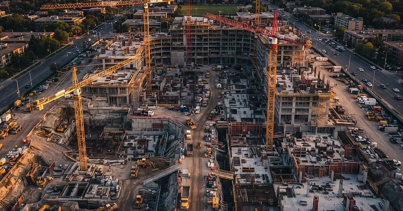
Skyline provides exterior aerial photography and video for commercial real estate teams that need a clear view of an entire property and its surroundings. Coverage is designed for facilities, commercial complexes, industrial complexes, warehouses, distribution sites, and similar commercial assets.
This service is limited to commercial properties and exterior aerial documentation. Skyline does not provide property appraisals, boundary surveys, building or roof inspections, engineering opinions, environmental assessments, or code-compliance determinations.
Applications
What We Deliver
Commercial Property Marketing
Exterior aerial photographs and video can present the scale, setting, access, parking, loading areas, building layout, and surrounding commercial context of a property for leasing, sale, portfolio, and stakeholder materials.
Facilities and Complexes
Document large facilities and multi-building commercial complexes from overview and selected detail angles so owners, managers, tenants, and project teams can understand the visible exterior layout.
Industrial and Warehouse Sites
Capture industrial complexes, warehouses, distribution facilities, yards, loading areas, access routes, and adjacent site context for presentations, planning discussions, and property records.
Exterior Condition Records
Create a dated visual record of accessible exterior areas for maintenance discussions, project planning, or later comparison. The imagery documents what was visible during the flight and is not a professional property or building inspection.
Benefits
Benefits for Your Team
Whole-Property Context
Show the relationship among buildings, parking, access, loading areas, exterior improvements, and the surrounding commercial area.
Purpose-Built Deliverables
Choose edited photographs, video, organized documentation, or a scheduled remote viewing session according to the commercial objective.
Large-Site Coverage
Document facilities, warehouses, and multi-building properties more efficiently than ground-level imagery alone.
Consistent Property Records
Use planned viewpoints on repeat visits to support visible change tracking and portfolio documentation when conditions permit.
Remote Stakeholder Review
When connectivity permits, authorized off-site participants can request useful exterior viewpoints during a scheduled live session.
Based in Yelm, Skyline Aerial Solutions provides scheduled drone services across Thurston, Pierce, Mason, Lewis, and Grays Harbor counties, including Olympia, Tacoma, Yelm, Centralia, and Shelton. Travel, airspace, and site conditions are reviewed for each project.
Get in Touch
Tell us what the operation requires.
Include the location, schedule, site conditions, and the people who will use the imagery or live view. We will follow up with the right service path.